trail review

Trail review

Tyler & Becca PCT

_DSC3336.jpg

In April we posted about Tyler & Becca plan to hike the Pacific Crest Trail. And they made it! We asked them a few questions about their trip. Talking to them makes me really look forward to hiking this summer. 

CC: What did you learn about your gear? 

T&B: We learned that quality gear is worth the investment. We did our homework and found gear that was going to fit our specific needs, but that would stand up to the abuse that we put it through. If on average a person spends 15 nights a year out backpacking the gear will last a good long while and is worth the investment. We were out 136 nights, which is equivalent to about 9 years of use that we put into our gear in one 4 1/2 month period. We had to do some minor mending and patching along the way, but overall everything is in great shape...except for our shoes. They all took a trip to the trash can.

colter_co_PCT

CC: What gear was worth its weight in gold, and what was not worth having? 

Worth its weight in gold:
Becca: CALORIES!, trekking poles, sleeping quilt, leuko tape (for blisters), Nike Pro Indy bra, bug headnet, baby powder

Tyler: CALORIES!, solar panel, Sony NEX 7 camera with 16-50mm lens, Patagonia Houdini wind jacket, fishing pole

- A little more on calories: All food that you are craving is worth carrying. Avacados, an entire block of cheese, a jumbo bag of Fritos, chocolate cake, no problem!

Not worth having:

Sawyer Mini water filter - go with the full size version, sunscreen (not recommended for everyone else. We tanned up pretty quickly and never used it again), bug spray (as long as you're walking 3 mph the mosquitos can't catch you. In camp we just put on more layers).

colter_co_PCT

CC: How did you alter your gear along the way?

T&B: The alterations were mainly to get rid of redundancies or gear that we thought we'd use but didn't. I ditched extra camera batteries once I had a good system down and we ditched a tarp to use as shade in the desert that we never used. Anything else that we would potentially need, but didn't want to carry was put into a "bounce box". Basically, you address a package to yourself two or three towns ahead and put in stuff that you might need. I had a big bottle of contact solution that I could use to refill my smaller one, extra socks and underwear, ziploc bags, and even some snacks and extra meals.

colter_co_PCT

CC: What was your favorite parts of the experience?

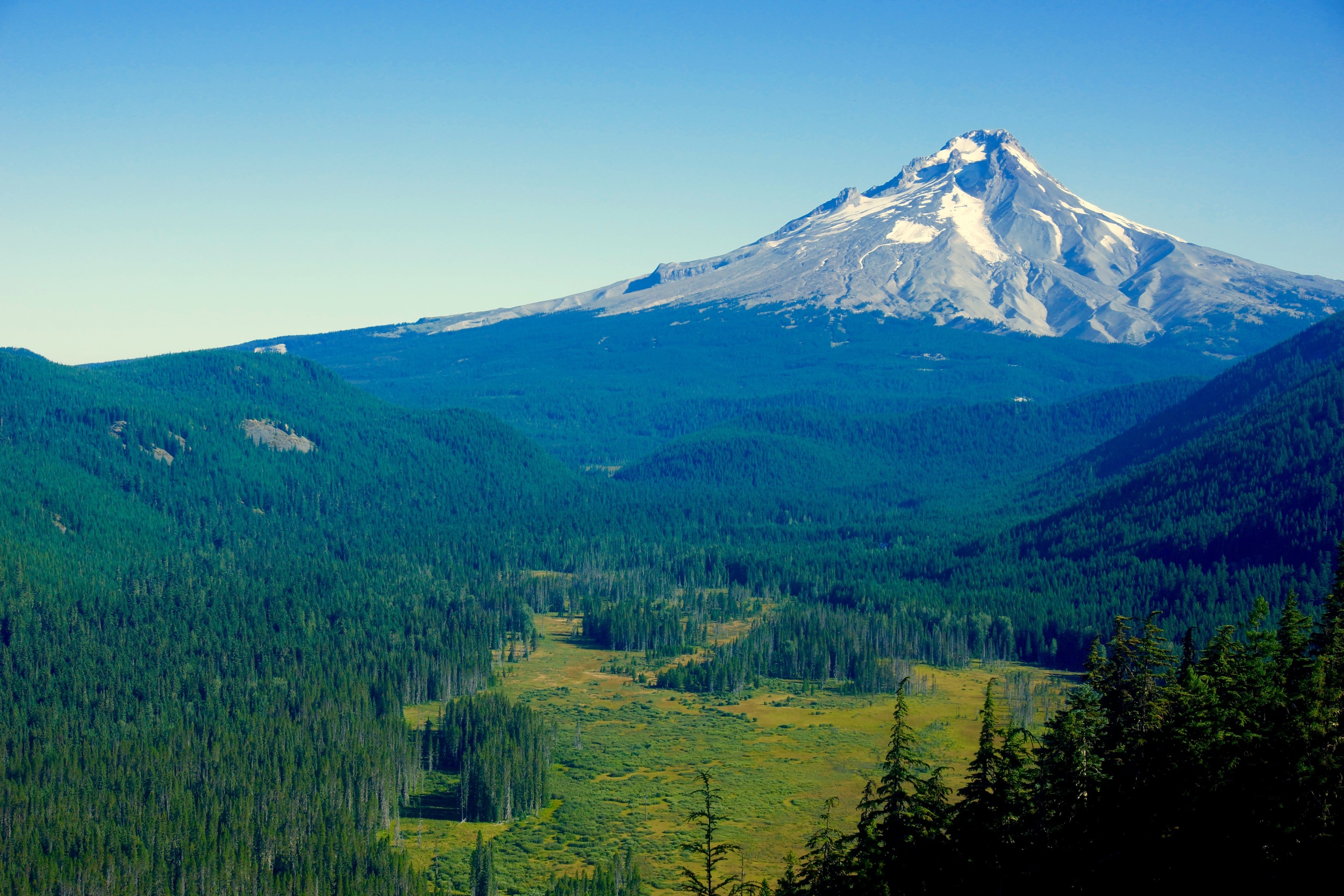
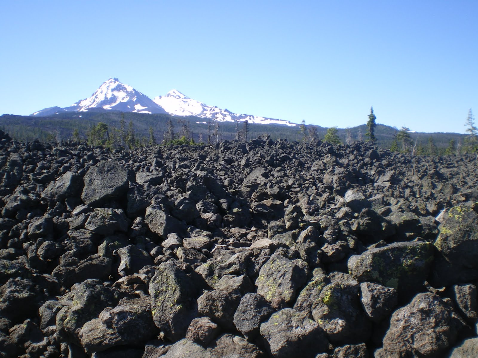
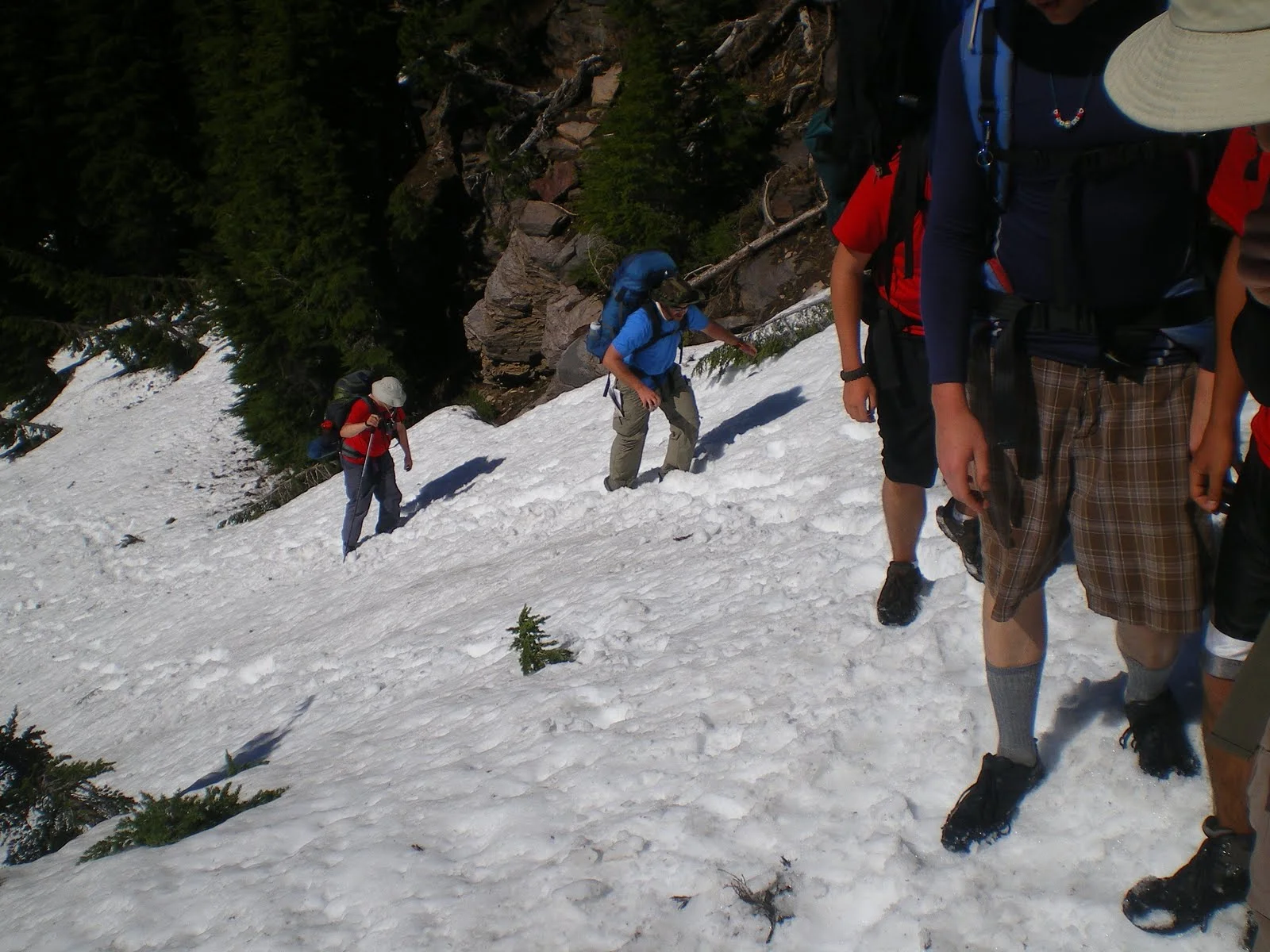
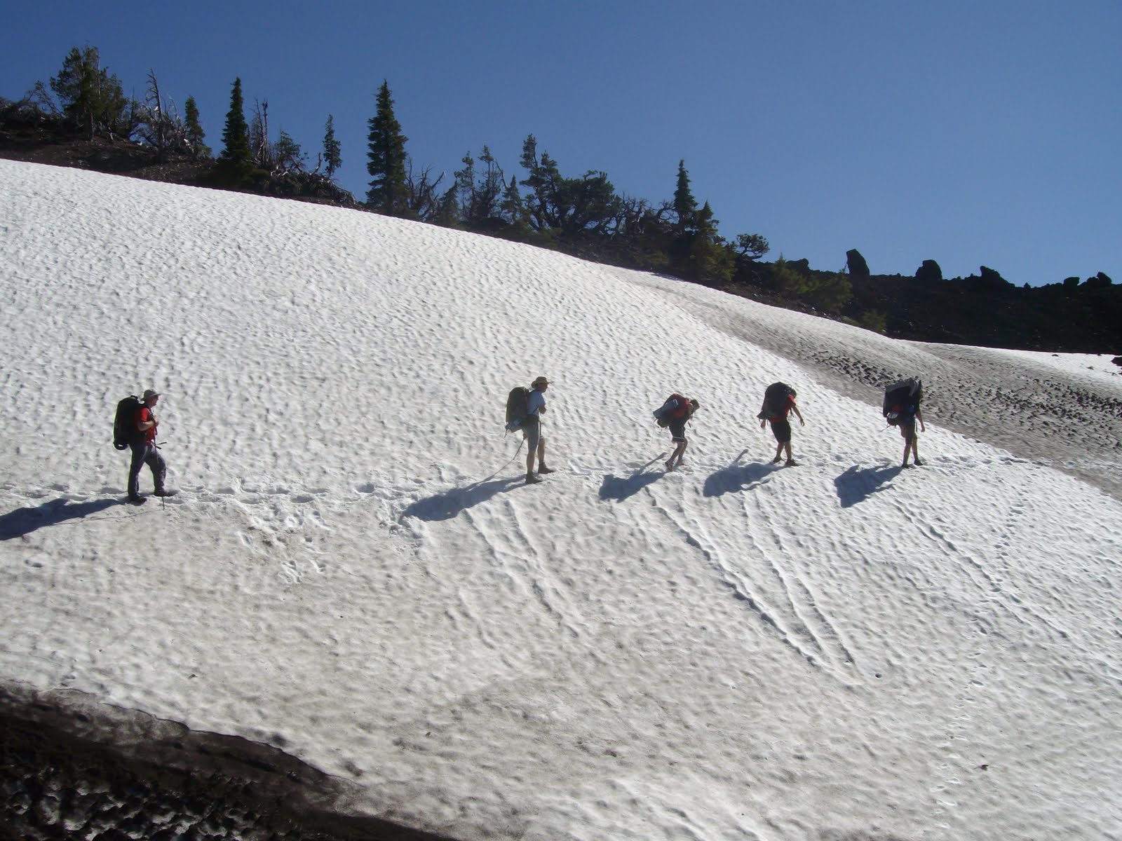
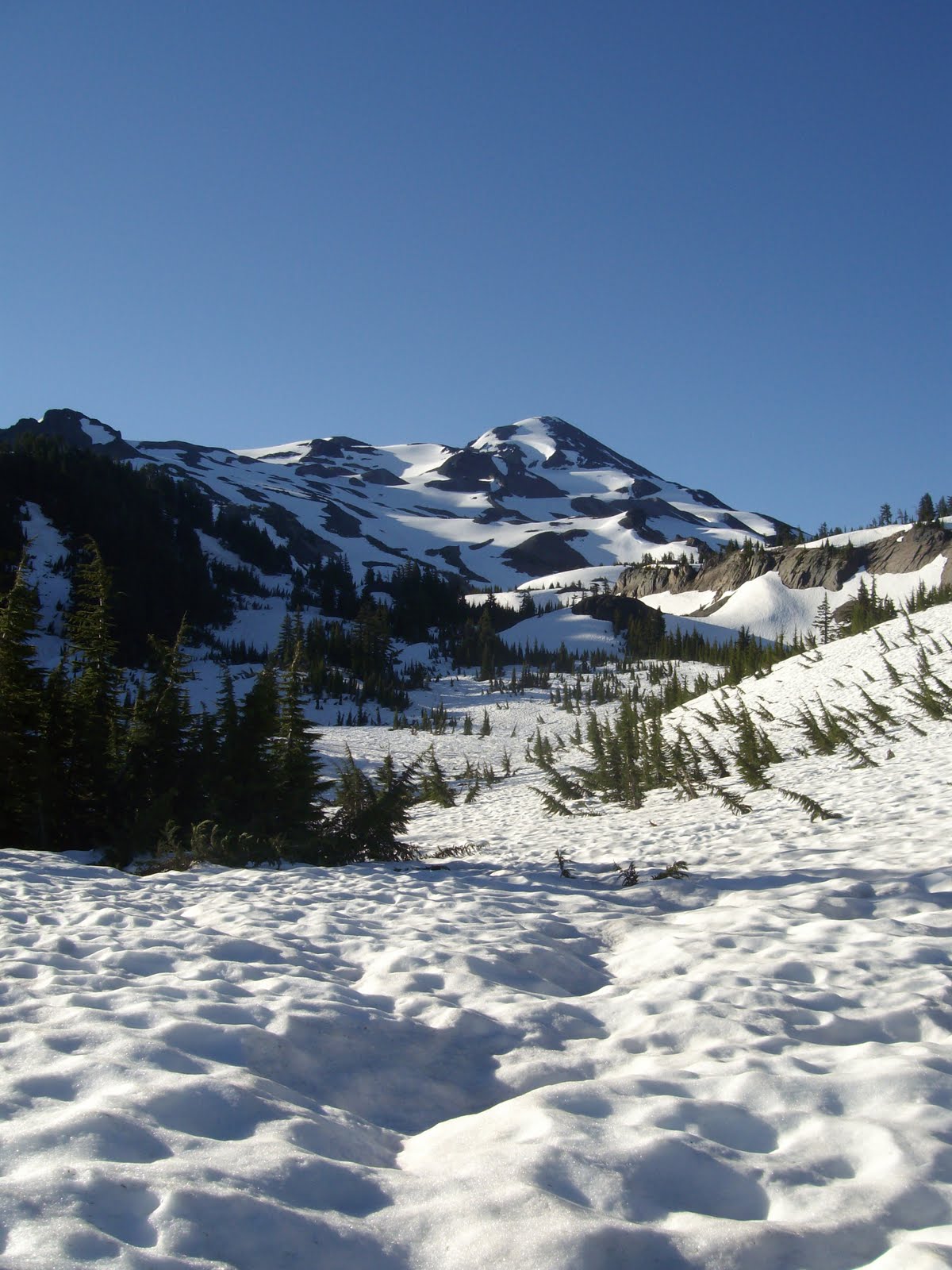
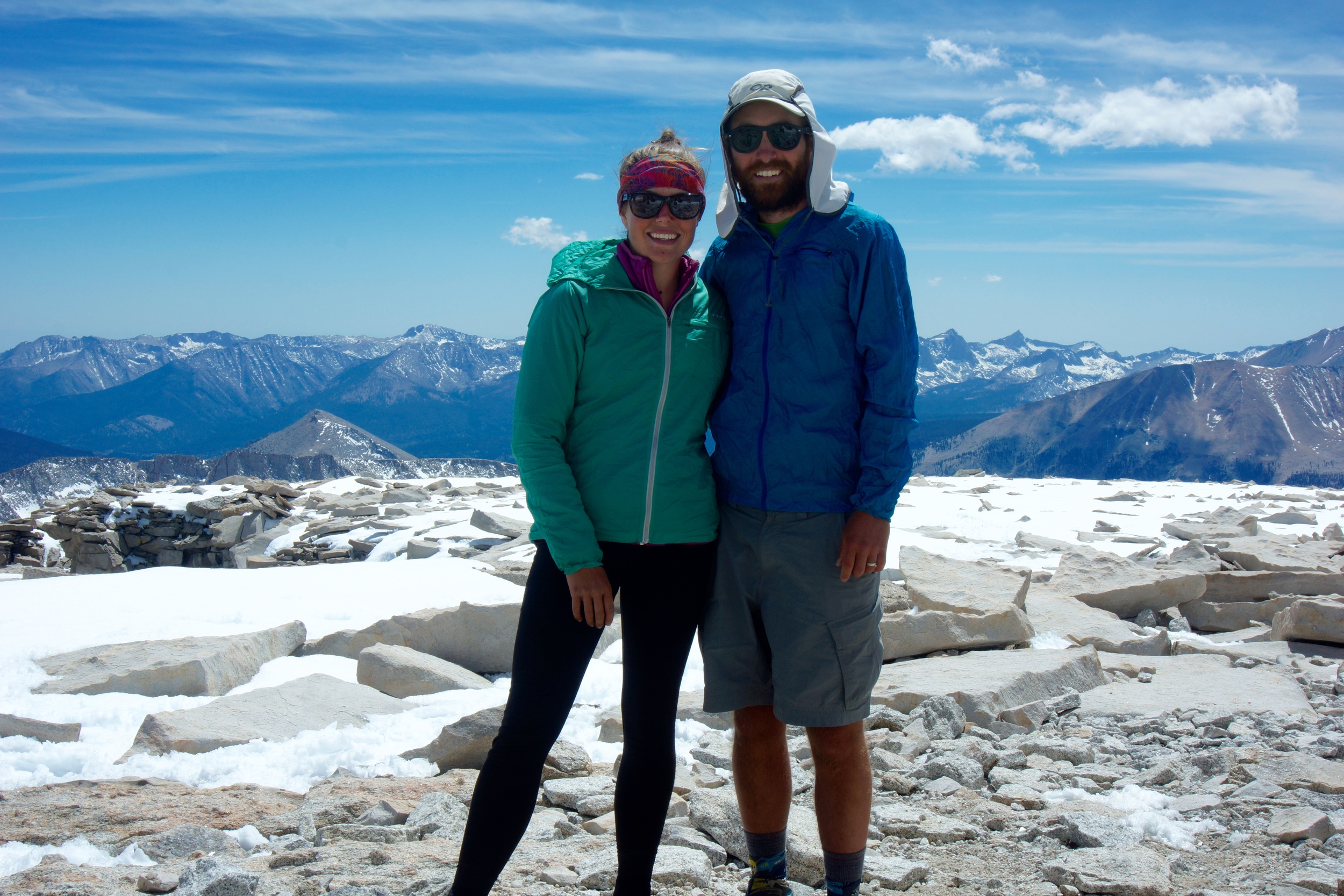
T&B: For Becca it was the trail life with all of the social interactions. For me, it was definitely the scenery and the opportunity to see some incredible parts of the country. We both really enjoyed hiking through the Sierras and any other big mountain pass. It is a hard and discouraging climb, but once you get to the top of the pass and see all of the lakes and beautiful scenery that lies ahead of you all of the hard moments melt away.


CC: What was the hardest part of the experience?

T&B: The hardest part was definitely the repetitive nature of getting up day after day to hike 20+ miles. You go to bed exhausted and wake up in the morning slightly less exhausted. Finding that motivation in the morning would be really difficult for us if we weren't hiking with each other. I don't know how solo hikers do it. We were a good source of motivation for each other and she kept me from hitting the snooze button daily. If you can make it past the first few weeks where your body is adjusting, then the rest is mostly mental. Your body get into such incredible shape that you are a walking machine. 

CC: Did you meet any interesting people on the trail?

T&B: Oh, so many! It takes a certain kind of crazy to spend 4 to 6 months living out of a backpack. All walks of life were represented, but the coolest part was that the trail was a level playing field. It doesn't matter if you work at McDonalds or are a doctor, everyone is able to be their true selves without judgement. There were the crazy hippie types, but they tended to be occupied with alcohol and drugs. We kind of separated ourselves from that crowd just by the pace that we set for ourselves. 

We made a handful of friendships that will last a lifetime. "Ricky Bobby" from Michigan, "Raddish" from Oregon, Tami from Oregon, "Diatom" from California, and "Salamander" and "Tree Beard" from Washington were our closest friends. No topic is off limits when you sit around picking your feet and popping blisters in front of someone. You get to know people pretty quickly.

CC: Did your Colter Co. bandanas come in handy? :)

T&B: Yes! A bandana for a quick wipe of the forehead on a steep climb, or added sun protection is always handy.

CC: Did you guys get hiker nicknames?

T&B: Yes, mine was "Nomad", because I was always exploring and didn't sit still when other people were just relaxing. It was usually because I was off exploring a stream or lake.

Becca's was "Rattles", because she is chatty and as some of our close friends said, "you tend to rattle on and on". 

Trail names have to be given to you by people that you're around, not self-appointed. Most of the time it comes from a personality trait or something quirky that you do. 

colter_co_PCT
colter_co_PCT
colter_co_PCT
colter_co_PCT
colter_co_PCT

Trail review

Zion National Park East Rim guest trail review

This trail review was written by Becca Christlieb, an avid backpacker and explorer of the SW. She lives in Las Vegas and has visited a lot of the amazing places nature has to offer in that area. 

Zion National Park is one of my most favorite places in the world to visit. It has amazing beauty anytime of the year. We decided to hike some trails on the 14th of Feb. Usually, there is a significant amount of snow this time of year, but thanks to an unseasonably warm year in the Southwest, hiking Zion was PERFECT.

We decided to do a trail that was a little less traveled, and less-known, which was the East Rim Trail. 

Zion National Park east rim trailhead

Zion has a shuttle system in place that adds about 45 minutes to travel time to get to the trail head, but thanks to hiking in the off-season, we were able to drive straight to the trail head. 

We started hiking in the late morning and headed up a series of long switchbacks until we essentially made it up the top of the canyon wall. Ignoring the turn off for the Hidden Canyon trail, we continued with the long switchbacks and enter into a small slot canyon.

slot canyon
slot canyon

Hiking through the slot canyon, and across a bridge we came upon a trail marker.

zion national park trail marker

The trail for the East Rim isn't obvious, and there was a man sitting right next to the sign who informed us that the sign was not the correct turn off. (He was wrong.) After hiking up the wrong trail for about 3/4 of a mile, we realized we had received the wrong information, we headed back down the trail and hooked onto the actual East Rim trail. We then crossed over a volcanic field with cairns as trail markers. This part of the hike is relatively flat compared to the previous switch backs.

East Rim trail Zion National Park

The "flat" portion of the trail soon gives way to another switchback section. This time, it is wooded and view of the high white cliffs become more visible.

zion national park east rim

Finally, (and it is quite the climb), we reached the top of the cliff to even more amazing views. 

zion national park east rim trail

From here, the hike is very flat and easy. We chose to go further on the trail for about another mile and sat down for a meal of spaghetti. Having forgotten our utensils, we improvised with sticks and rocks. I broke the rocks down to a manageable size. 

backpacking cooking

The trail continues on for several miles to Jolley Gulch and eventually the East Entrance, but we chose to head back the way we came in. The views with the lighting on the way down were spectacular.

zion national park east rim

Thank you, Becca, for a wonderful trail review and some breathtaking photos. 


Trail review

Trail review: Three Sisters Wilderness

three sisters panorama

A few years ago I had the chance to lead a group of Scouts on a 50 mile hike through the Three Sisters Wilderness area in Central Oregon. This hike offers an incredible variety of terrain and truly breathtaking scenery. The main attractions are North Sister, Middle Sister and South Sister. But Mt. Bachelor, Broken Top, Mt. Washington and Three Fingered Jack are all visible along the trek. All these peaks are extinct or dormant volcanos which makes the trip interesting for anyone interested in geology. We found football sized chucks of obsidian at one point near the trail. 

We started out on the Pacific Crest Trail near Dee Wright Observatory on highway 242. The first stretch is over barren volcanic rock as far as the eye can see. After a few miles you get into trees with a few beautiful lakes along the trail. The trail goes around cinder cones as it climbs up and around the Three Sisters. 

three sisters backpacking

The year we went was a very late winter. We ended up hiking a day and a half through snow, navigating by map and compass to stay on course. It was exhausting but incredibly beautiful. We met another group of hikers in a little flat area. They make the trip every year around that same time and had never seen that much snow before. The area that was still under 2-3 feet of snow usually featured a grassy meadow and wildflowers fed by a small spring. 

three sisters backpacking

We made our way down out of the snow and wound around South Sister, past the cow pie (a giant lava flow coming off South Sister. You’ll know why it’s called that when you see it,) and ended up at Elk Lake. We hit a couple other lakes in the area which provided a substantial craw daddy dinner on evening. Delicious! 

crawfish

I would highly recommend this stretch of trail. Although it would have been easier later in the year when the snow was melted (we went in the middle of July) it was absolutely beautiful with the snow. If you do go in the snow, make sure you know how to navigate! Also a spot doesn’t hurt (http://www.findmespot.com/en/). We certainly had one for the trip. 

three sisters backpacking

Let me know if you’ve hiked the area, or have any other suggestions in the area.